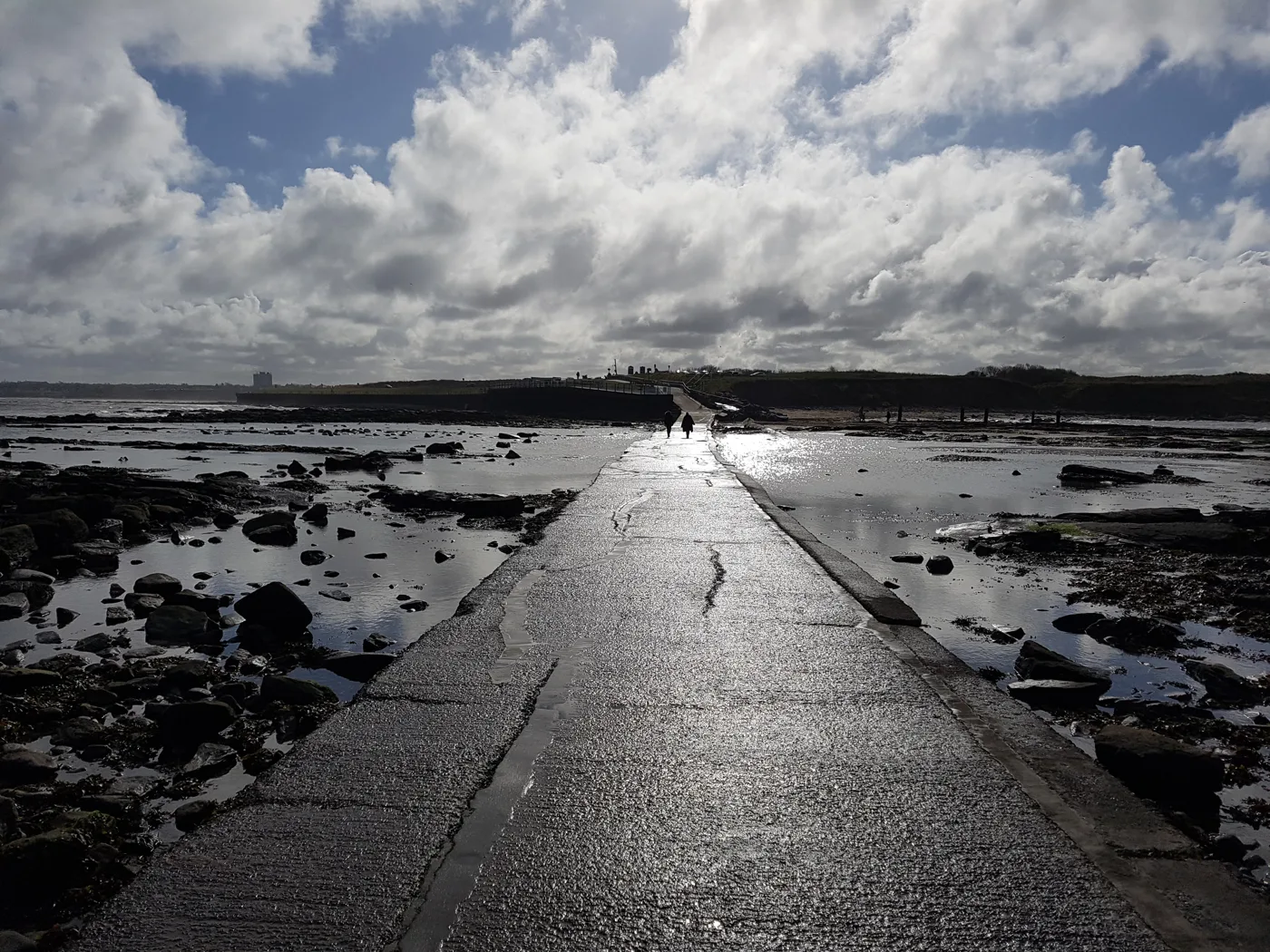

The council has applied to tear out and recast the 1960s causeway to St Mary's Island. The crossing would close from May to August 2027. Comments are open to 15 October.
The causeway to St Mary’s Island would be broken up and rebuilt under plans lodged by North Tyneside Council. Public access to the island would be shut while the work is done, between 1 May and 31 August 2027.
The council is both the applicant and the planning authority. It has applied for planning permission (26/01282/FUL) and listed building consent (26/01283/LBC) to remove the tidal causeway and build a replacement. The application was validated on 17 September. A public notice dated 24 September gives 21 days for comments (council statutory notice).
Why the council says it has to go
The concrete causeway, roughly 170m long, was built in the 1960s. It replaced a 1929 crossing whose middle section was regularly under water. It is submerged by the tide twice a day.
The environmental statement’s non-technical summary says the structure is “showing clear signs of ongoing degradation”. It has been kept going with patch repairs, including metal sheets laid over the surface to make a level platform (non-technical summary).
The design and access statement adds more detail. There are several crack repairs along its length, the latest in 2025 on a 5m stretch near the headland. Voids have opened beneath the concrete, and some large broken pieces still sit among the rocks. It calls the causeway’s condition “end-of-life”, and warns that doing nothing would raise the risk of “unplanned closures” (design and access statement).
What the work involves
The documents describe a like-for-like replacement rather than a new design:
- the old causeway broken out down to the bedrock, working at low tide
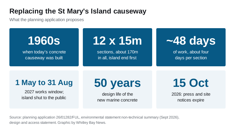
- rebuilt in 12 sections of 15m, starting at the island end and working back to the mainland
- about four days per section, roughly 48 working days in all
- new marine-grade concrete, 300mm to 500mm deep, with a 50-year design life
- water and electricity supplies to the island disconnected, diverted and reconnected
- a site compound on the hard standing of the northern St Mary’s Island car park
- boulders placed on the sand near the mainland end to create new rock-pool habitat
A second option, lining both sides with permanent rock armour, was rejected. The summary says it would have widened the causeway and changed the habitat and its appearance more.
The island would be closed to visitors
“Due to the risk to public safety, public access across the causeway will be closed during the construction phase,” the summary says. Boats would be provided for residents and workers where needed.
That rules out a visit to the lighthouse or the visitor centre for the whole works window. The work is expected to start in summer 2027. It has to be finished between 1 May and 31 August because of the site’s ecological sensitivity.
No work is planned on Sundays or bank holidays. Some shifts may fall outside normal hours to catch the tides, and construction lighting may be used at dusk and dawn.
Why the ecology matters here
The causeway sits inside, or next to, a long list of protected sites. They include:
- the Northumbria Coast Special Protection Area and Ramsar site
- the Tynemouth to Seaton Sluice and Northumberland Shore SSSIs
- two Marine Conservation Zones
- the St Mary’s Island Local Nature Reserve
That is why the application carries more than 40 documents, among them reports on birds, marine life, noise and water quality. The environmental statement concludes that, with mitigation, no significant adverse effects are predicted. The main lasting loss is a small area of intertidal rock and sand. The boulders, and statutory biodiversity credits if needed, are meant to make up for it. Once finished, it expects a “minor positive effect” from safer access. The work below the high-water mark also needs a marine licence from the Marine Management Organisation.
What it means for you
- Have your say by 15 October. The press notice and site notice both expire on 15 October. Comments go to the council’s planning service, and the documents are on the planning portal.
- Nothing changes yet. The island stays open as normal, tides permitting. The planning record lists the decision as delegated to officers, with a determination deadline of 12 November 2026.
- Planning a lighthouse visit? Next summer looks like the wrong time. Go before May 2027, or wait until the new causeway opens.
- The causeway compound would take space in the northern car park. Our parking page covers the alternatives, and our roadworks page will carry the dates once a contractor sets them.
Sources
- Planning application 26/01282/FUL, North Tyneside Council planning portal (received 11 September, validated 17 September, press and site notices expire 15 October, determination deadline 12 November 2026)
- Statutory notice: Land at St Mary’s Island Causeway, 26/01283/LBC and 26/01282/FUL, dated 24 September 2026
- Environmental Statement Volume 3, Non-Technical Summary, September 2026 (Fairhurst for North Tyneside Council)
- Design and Access Statement, 26/01282/FUL
Have your say